
Posted on Dec 31, 2024

America is larger now, by declaration of State Department
4.12K
20
2
16
16
0
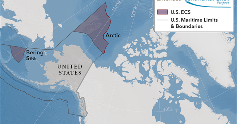
The State Department enlarged the country’s geography, citing international law, by defining how far under the sea the continental shelf extends. The new additions are spread across seven areas of ocean, and more than half of the claim is in the Arctic.
“America is larger than it was yesterday," said Mead Treadwell, a former Alaska lieutenant governor and former chair of the U.S. Arctic Research Commission. "It's not quite the Louisiana Purchase. It's not quite the purchase of Alaska, but the new area of land and subsurface resources under the land controlled by the United States is two Californias larger."
State Department project director Brian Van Pay said it took multi-agency fieldwork spanning 20 years for scientists to gather data about the shape of the seafloor and measuring sediment layers.
“Forty missions at sea, going to areas that we've never explored before, finding entire seamounts we didn't even know existed," Van Pay said. "And, if you add up all the time that our scientists spent at sea, it's over three years of data collection.”
America is larger now, by declaration of State Department
Posted from alaskapublic.org
Posted 12 mo ago
Responses: 2
Read This Next
